 Amalfi City Guide
Amalfi Map: Attractions, Beaches, Piers & Walking Paths
This comprehensive amalfi map and orientation guide charts every essential coordinate across the historic maritime republic and its immediate coastline. We map official ticket windows, passenger ferry boarding pontoons, SITA bus bays, pedestrian tunnels, and scenic clifftop trails so you navigate effortlessly without getting stranded in traffic gridlocks or climbing dead-end stone staircases. Discover broader itineraries on things to do in Amalfi and Amalfi destination guide.
Quick answer
Amalfi is compact and walkable: the main spine runs 1.2 km from the ferry piers at Molo Pennello up through Piazza Duomo and into the Valle dei Mulini. Avoid driving completely; public ferries and SITA buses depart from the waterfront.
Key takeaways
- The main waterfront hub holds both the Travelmar ferry ticket kiosks on Molo Pennello and the SITA bus terminal on Piazza Flavio Gioia.
- A convenient pedestrian tunnel under the eastern promontory connects Amalfi directly to the quiet neighboring village of Atrani in just 10 minutes.
- Motorized vehicles without local municipal permits cannot enter the historical center; parking at Luna Rossa costs $9.40–$14.00 (€8.00–€12.00) per hour.
Interactive Amalfi Map & 40 Essential Points of Interest
Explore 40 verified coordinates across Amalfi, neighboring Atrani, and Valle dei Mulini. Filter by category to view historic monuments, hiking trails, secluded beaches, iconic dining spots, and key transport terminals with live walking links.
Monuments & Heritage 10 pins
- Duomo di Amalfi (Cathedral of St. Andrew)€3.00 complex ticketCheck AvailabilityIconic 62-step staircase, Arab-Norman polychrome facade, 1060 Byzantine bronze doors, and Baroque crypt of Apostle St. Andrew.
- Chiostro del Paradiso€3.00 (included in Duomo)13th-century Moorish arched cloister built between 1266 and 1268 as a burial cemetery for Amalfi's noble merchant families.
- Museo Diocesano & Basilica del Crocifisso€3.00 (included in Duomo)Oldest paleo-Christian cathedral dating to 848 AD; houses the 1297 Angevin Mitre and solid silver reliquary busts.
- Museo della Carta (Paper Mill Museum)€4.50 demo ticketRestored 13th-century hydraulic paper mill with operating wooden drop hammers and handmade cotton rag papermaking demonstrations.
- Antico Arsenale della Repubblica di AmalfiFree / €2.00 museum11th-century dual stone-vaulted naval shipyard where Amalfi built combat galleys with up to 120 oars.
- Fontana di Sant'Andrea ApostoloFree public access18th-century Baroque marble fountain on Piazza Duomo featuring Saint Andrew flanked by mermaids and cherubs.
- Monumento a Flavio GioiaFree landmarkProminent bronze monument honoring the Amalfitan navigator credited with introducing the magnetic mariner's compass.
- Chiesa di San BiagioFree access11th-century Romanesque parish church hidden in upper vaulted alleyways, with antique 18th-century majolica floor tiles.
- Collegiata di Santa Maria Maddalena (Atrani)Free entryFounded 1274 on the cliffside above Atrani; features a distinctive yellow-and-green majolica dome and coastal bell tower.
- Grotta dello Smeraldo (Emerald Grotto)€7.00 rowboatNatural marine cave in Conca dei Marini renowned for intense cobalt and emerald water reflections and underwater ceramic nativity.
Trails & Viewpoints 6 pins
- Riserva Naturale Orientata Valle delle FerriereFree trail / €5.00 sanctuaryProtected microclimate canyon with tumbling waterfalls, moss-draped limestone cliffs, and living Tertiary giant ferns.
- Torre dello Ziro Clifftop WatchtowerFree access hike15th-century cylindrical anti-Saracen watchtower perched on Monte Aureo ridge with dramatic 360° panoramas over Amalfi and Atrani.
- Belvedere del Cimitero MonumentaleFree viewpointHigh vantage point on the eastern cliffside offering the quintessential postcard perspective directly down onto Piazza Duomo.
- Sentiero dei Limoni (Path of the Lemons Trailhead)Free public trailPanoramic stepped mule track connecting Maiori and Minori through working terraced groves of IGP Sfusato Amalfitano lemons.
- Sentiero degli Dei (Path of the Gods - Bomerano Trailhead)Free public trailSpectacular clifftop trail starting in Bomerano (Agerola) at 630m altitude and contouring sheer cliffs toward Positano.
- Cascata del Canneto (Upper Mills Waterfall)Free accessCascading forest waterfall in the Canneto river gorge, surrounded by scenic overgrown ruins of medieval paper factories.
Beaches & Swimming 7 pins
- Spiaggia Marina Grande (Amalfi Central Beach)Free sector / €25–€50 lidoAmalfi's expansive central shoreline with dark volcanic pebbles, crystal water, and front-row views of town houses.
- Lido Delle Sirene Beach & Reef€30–€45 lido packageSheltered western pebble cove beside the harbor pier, featuring sun decks and deep-water swimming off natural limestone rocks.
- Spiaggia di DuoglioFree sector / €30–€40 lidoTurquoise water swimming cove accessible via 400 cliffside steps from SS163 or a 5-minute boat shuttle from Amalfi port.
- Spiaggia di Santa CroceFree / €30–€45 lidoPristine gravel cove beneath sheer limestone amphitheaters, home to seafood beach clubs reached by water taxi.
- Spiaggia di AtraniFree sector / €20–€35 lidoSheltered dark-sand and pebble beach situated under the dramatic arched viaduct of Atrani, shallower water entry.
- Spiaggia di Castiglione (Ravello)Free / €30 lidoDeep swimming cove flanked on three sides by sheer cliffs, reached via 180 stone steps from the coastal highway below Ravello.
- Spiaggia del Fiordo di FuroreFree natural beachDramatic sea gorge cove bridged by the 30-meter-high highway viaduct, former historic fishing settlement with monazzeni.
Dining & Pasticcerie 10 pins
- Pasticceria Andrea Pansa (Since 1830)€2.50–€7.00Historic brass-counter cafe on Piazza Duomo celebrated for Delizia al Limone, sfogliatella Santa Rosa, and espresso.
- Trattoria Da Gemma (Since 1872)€45–€75Amalfi institution renowned for hand-rolled scialatielli ai frutti di mare, fresh carpaccio di spigola, and terrace dining.
- Ristorante Marina Grande€55–€95Upscale beachfront restaurant on wooden piers serving refined contemporary seafood pasta and fresh catch-of-the-day.
- Ristorante Da Ciccio Cielo Mare e Terra€60–€90Celebrated family trattoria in cliffside hamlet of Lone, cooking with organic produce from private terraced gardens.
- Ristorante Lido Azzurro€45–€70Harborside dining at the foot of Molo Pennello, serving line-caught pezzogna in crazy water (all'acqua pazza) and fried calamari.
- Pizzeria Donna Stella€12–€22Authentic Neapolitan wood-fired pizza served under a fragrant canopy of real lemon tree pergolas in upper residential alleys.
- Trattoria dei Cartari€25–€40Beloved local trattoria in Valle dei Mulini serving traditional pasta e patate with provola cheese and braised rabbit stew.
- Ristorante Savò (Atrani)€30–€50Intimate trattoria on Piazzetta Umberto I in Atrani, noted for homemade lemon gnocchi and grilled local squid.
- Bar Birecto (Atrani)€1.50–€5.00The open-air social living room of Atrani directly beneath the viaduct, ideal for morning cappuccino or late afternoon aperitivo.
- Pasticceria Sal De Riso (Minori)€3.50–€9.00Showcase pastry boutique of master pastry chef Salvatore De Riso on Minori seafront, creator of the Ricotta e Pere cake.
Piers, Transit & Parking 7 pins
- Molo Pennello Ferry TerminalFerry tickets €4.00–€28.00Primary maritime passenger terminal for Travelmar, Positano Jet, and Capri hydrofoils; luggage storage at dock kiosk.
- Piazza Flavio Gioia SITA Bus TerminalBus tickets €1.50–€3.10Main regional bus departure bays connecting Amalfi directly to Ravello, Positano, Sorrento, and Salerno.
- Parcheggio Luna Rossa (Rock Garage)€8.00–€12.00 / hrMulti-level covered municipal parking garage excavated into the mountain; elevators connect directly to pedestrian tunnels.
- Galleria Pedonale Amalfi-Atrani (Pedestrian Tunnel)Free public accessFlat, well-lit, air-conditioned 9-minute mountain tunnel bypassing highway traffic directly into Atrani's main square.
- Travelmar Ticket Kiosk & Luggage DepotStorage €5.00–€8.00 / bagOfficial maritime ferry ticket sales windows and secure day-use baggage drop facility at the harbor entrance.
- Piazzale dei Protontini Waterfront Parking€5.00–€8.00 / hrOpen-air municipal car parking situated along the outer western harbor arm near the helipad and pier breakwater.
- Municipal Taxi Stand (Piazza Flavio Gioia)Fixed municipal tariffsOfficial white taxi ranks with fixed regulated rates for Ravello (€40–€50), Positano (€50–€70), and Salerno.
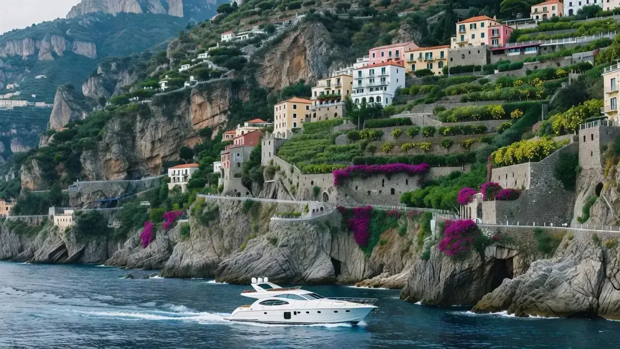
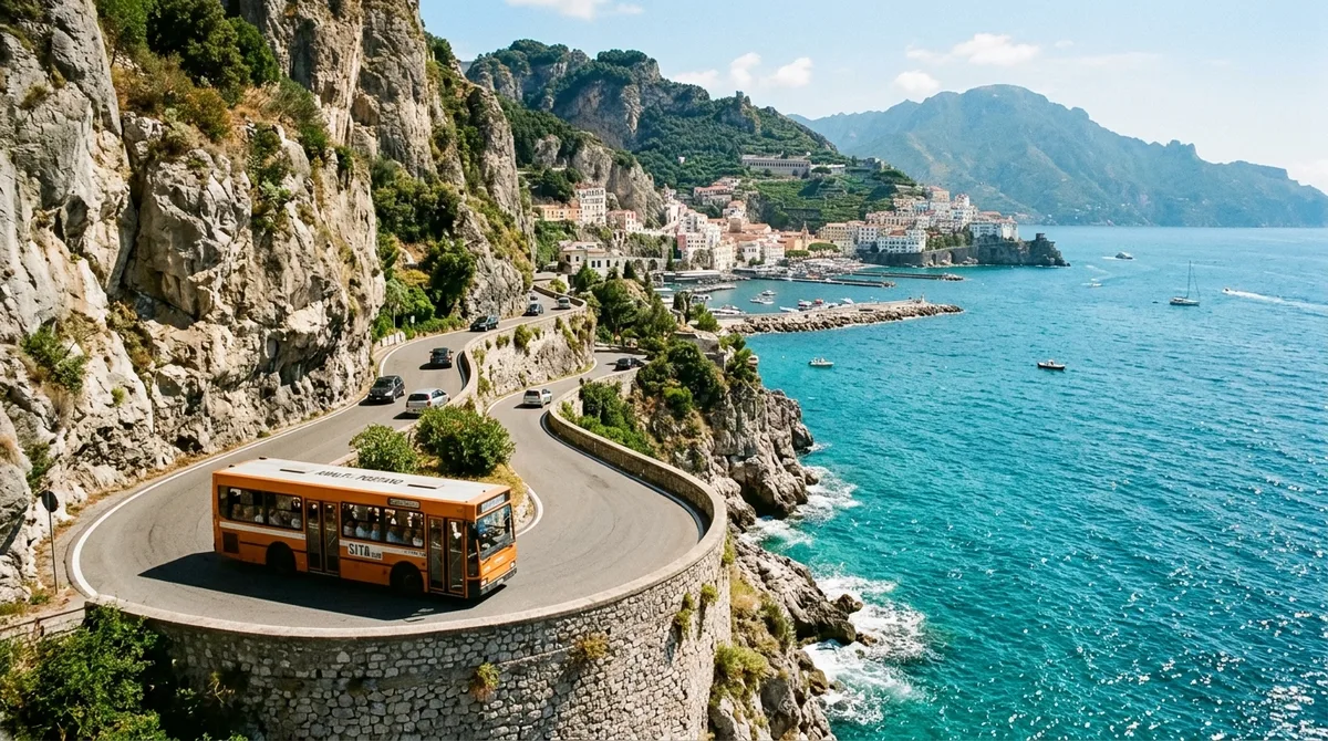
Panoramic view of Amalfi harbor, piers, and cliffside streets marked on the Amalfi map guide
Amalfi Orientation: The Three Main Geographic Sectors
Essential context, operational principles, and field-tested advice for understanding amalfi orientation: the three main geographic sectors.
Waterfront Promenade & Port: Molo Pennello & Piazza Flavio Gioia
This sea-facing apron is Amalfi's logistical epicenter. Scheduled passenger ferries to Positano, Capri, and Salerno dock along the concrete eastern breakwater of Molo Pennello. Directly adjacent sits Piazza Flavio Gioia, holding the terminal bus bays for SITA routes 5070 and 5080, the municipal taxi rank, and luggage drop storage counters.
Historic Piazza Duomo & Corso Lorenzo d'Amalfi
Passing inland beneath the medieval stone arches of Porta della Marina leads directly into Piazza Duomo. Dominated by the 62 marble steps of the Duomo di Amalfi, this lively pedestrian hub flows directly into Corso Lorenzo d'Amalfi (historically known as Ruga del Mercato), packed with artisan leather ateliers, ceramic boutiques, and historic cafes.
Upper Valle dei Mulini: Mill Stream to Forest Waterfall Trails
Continuing northward up the valley follows the Canneto stream into the quiet, residential Valle dei Mulini. The bustling tourist crowds vanish, replaced by rushing mountain water, centuries-old stone paper mills, and the Museo della Carta. Farther up the gorge, paved streets give way to the fern-lined wilderness trails of the Valle delle Ferriere.
 from $38.50
Amalfi: Guided Walking Tour with Cathedral & Cloister Visit
2-hour historical walking tour through Amalfi's medieval lanes with ticket and licensed guide into Duomo di Sant'Andrea and the Chiostro del Paradiso.
Check Availability from $75.00
Amalfi to Positano & Emerald Grotto: Coastal Boat Cruise with Swimming
4-hour small-group boat cruise from Amalfi Molo Pennello past Furore Fjord to Positano with swim stops, snorkeling masks, and chilled prosecco.
Check Availability from $480.00
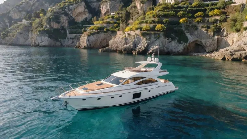
Private Gozzo Boat Charter with Skipper from Amalfi Pier
4-hour private boat hire with licensed captain for up to 6 people: complete custom itinerary, fuel, snorkeling equipment, and open bar included.
Check Availability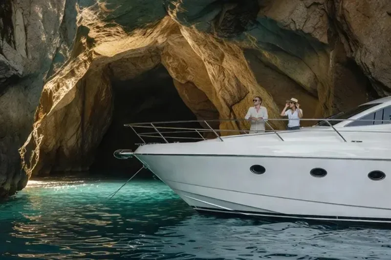 from $145.00
Private Amalfi & Atrani Medieval Alleys Guided Historical Walk
2.5-hour exclusive private historical walk linking Amalfi and medieval Atrani through covert alleyways, doge election churches, and panoramic clifftop lanes.
Check AvailabilityPrices, ratings and details are the platform's own. Dollar figures are the listed prices. The platform bills in your account's currency.
Related Planning & Orientation Guides
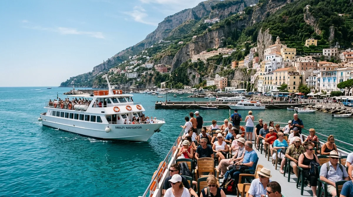
Ferry Routes & Timetables
Complete schedules, ticket fares, and pier navigation for Amalfi ferries.
Getting Around the Coast
Detailed SITA bus rules, rental scooter caveats, and taxi rates compared.
Where to Stay in Amalfi
Neighborhood breakdown: waterfront vs upper valley vs cliffside hotels.
Amalfi Town Walking Distances & Orientation Matrix
Straightforward walking transit times between central Amalfi landmarks, bus stops, ferry piers, and neighbor villages.
| Starting Point | Destination | Walking Distance | Gradient / Steps | Shortest Route Tip |
|---|---|---|---|---|
| Piazza Flavio Gioia (Bus Hub) | Molo Pennello (Ferry Pier) | 180 meters (2 min) | Completely flat | Follow wide harbor promenade past the ticket kiosks. |
| Piazza Flavio Gioia | Piazza Duomo (Cathedral) | 220 meters (3 min) | Gentle slope (no steps) | Walk through the historical arched gateway (Porta della Marina). |
| Piazza Duomo | Museo della Carta | 1.1 km (15 min) | Gentle uphill (+45m) | Follow central street Via Lorenzo D’Amalfi along the valley floor. |
| Piazza Duomo | Atrani Central Square | 800 meters (10 min) | Flat via mountain tunnel | Take elevator or stairs to Luna Rossa tunnel for lit pedestrian route. |
| Piazza Duomo | Valle delle Ferriere Sanctuary | 3.8 km (75 min) | Steep uphill trails (+240m) | Past paper museum, follow trail markers along Canneto river. |
Topographical Orientation: Sea Level vs. Hillside Quarters
Essential field-tested logistics, verified local guidance, and practical advice for Amalfi Map: Attractions, Beaches, Piers & Walking Paths.
The 3 Distinct Altitude Levels of Amalfi Town
Understanding Amalfi’s three-dimensional topography prevents exhaustion:
Level 1: The Maritime Waterfront (0 to 5 meters elevation): Encompassing Molo Pennello, Piazza Flavio Gioia, and the seaside promenade Corso delle Repubbliche Marinare. This zone is flat, paved with wide stone flags, completely wheelchair accessible, and hosts the ferry ticket booths, SITA bus bays, taxi stands, and beach clubs.
Level 2: The Historic Market Valley (10 to 70 meters elevation): Passing through the ancient Porta della Marina archway brings you into Piazza Duomo. From here, Corso Lorenzo d’Amalfi runs north along the floor of the Canneto river canyon into the Valle dei Mulini. The slope is gentle and paved, lined with artisan ceramic boutiques, gelaterias, and trattorias.
Level 3: The Cliffside Residential Quarters (80 to 200+ meters elevation): Flanking the valley floor are the ancient cliffside residential quarters—Vagliendola to the west and San Basilio to the east. These neighborhoods are labyrinthine vertical mazes of whitewashed stone arches (supportici), narrow tunnels, and sheer staircases. There are zero cars or roads here; transport is 100% on foot. Exploring these vertical quarters is exactly what Amalfi walking tours are made for, since a guide who knows the stairways keeps the maze from wearing you out.
Walking from Amalfi to Atrani: The Mountain Tunnel Shortcut
Atrani is Italy’s smallest independent municipality, sitting in the neighboring canyon just 700 meters east of Amalfi. While walking along the narrow vehicular SS163 road around the rocky headland is hazardous due to blind curves and heavy traffic, a safe, modern pedestrian tunnel connects the two towns:
1. From Piazza Flavio Gioia, walk 400 meters east along the seaside sidewalk to the entrance of Parcheggio Luna Rossa. 2. Enter the garage pedestrian lobby and take the lit, ventilated tunnel bored through the rock face. 3. In just 4 minutes of flat, sheltered walking, you emerge directly into the scenic historic alleyways of Atrani, arriving in peaceful Piazza Umberto I within 2 minutes.
Offline Navigation Tips in Deep Stone Alleys
Smartphone GPS signals degrade rapidly inside Amalfi’s deep limestone canyon and covered stone passages:
- ✓ Download Offline Maps: Download the entire Campania region in Google Maps or Maps.me before leaving your hotel Wi-Fi.
- ✓ Look for Tile Street Signs: Intersections in the pedestrian quarters feature hand-painted ceramic tile signs (maioliche) embedded in stone walls pointing to "Duomo", "Valle dei Mulini", or "Atrani".
- ✓ Follow Gravity When Lost: If lost in the labyrinth of upper residential staircases, simply follow any descending staircase downhill. All descending stairs eventually terminate at Corso Lorenzo d’Amalfi or the sea.
Navigating Amalfi's Medieval Architecture & Hidden Alleys
Orientation guidance for understanding the vertical layout of Amalfi's historic center.
The Architecture of Supportici (Arched Passageways)
Unlike flat Renaissance cities, medieval Amalfi was constructed inside a steep river gorge to defend against Saracen naval raids. The town is unified by supportici—covered vaulted tunnels and stairways cut through private residential buildings. Navigating these whitewashed passages reveals intimate courtyards, ceramic shrines to the Madonna, and quiet fountains completely hidden from the main street.
Key Orientation Landmarks in Town
Amalfi's layout revolves around three main anchors: Piazza Flavio Gioia (the sea-level bus terminal and harbor pier entrance), Piazza Duomo (the social heart dominated by the cathedral steps), and Via Lorenzo D'Amalfi / Via Pietro Capuano (the main pedestrian thoroughfare leading gently uphill into Valle dei Mulini).
Detailed Walking Routes: From the Sea to the Mountain Hamlets
Essential field-tested logistics, verified local guidance, and practical advice for Amalfi Map: Attractions, Beaches, Piers & Walking Paths.
Step-Count and Elevation Breakdown for Walking Routes
Practical hiking and walking metrics across key Amalfi town corridors:
Waterfront Pier to Piazza Duomo: 250 meters, flat terrain, 0 steps, 3 minutes walking.
Piazza Duomo to Paper Museum (Via delle Cartiere): 900 meters, gentle +55m incline, 12 stone steps, 14 minutes walking.
Amalfi to Pogerola Mountain Hamlet: 2.2 km, +305m elevation gain, 850 stone steps, 55 minutes strenuous uphill hike.
Amalfi to Atrani via Luna Rossa Tunnel: 700 meters, flat terrain, 0 steps, 8 minutes walking.
2026 Practical Field Guide: Timing, Payments & Local Etiquette for Amalfi Map
Crucial on-the-ground operational rules, financial realities, and daily visitor protocols to ensure a smooth, rewarding experience at Amalfi Map.
Optimal Visiting Windows & Peak Crowd Flow at Amalfi Map
Experiencing Amalfi Map without overwhelming crowds requires understanding the sharp contrast between day-tripper hours and resident rhythms. Tour buses from Naples and Sorrento arrive along the coastal highway between 10:00 and 10:30, releasing high passenger volumes into public plazas and popular landmarks until approximately 15:30. By contrast, the early morning hours between 07:30 and 09:30 offer tranquil streets, cool temperatures, and pristine photographic light where limestone cliffs glow gold.
During July and August, midday temperatures routinely climb above 34°C (93°F); taking a midday pause in shaded cafes or valley interiors between 12:30 and 15:00 protects you from heat exhaustion while allowing you to enjoy a second sightseeing wave after 16:30 when soft evening breezes (ponente) begin to blow.
Payment Realities, Local ATMs & Avoiding Conversion Surcharges
While European legislation mandates card acceptance for retail purchases, daily life on the Amalfi Coast frequently demands physical euro cash. Municipal public restrooms (€1.00 coin turnstiles), Tabacchi bus ticket counters, coin-operated beach rinse showers, and luggage porter tips operate exclusively on cash. When withdrawing funds, steer completely clear of standalone yellow-and-blue Euronet ATMs positioned near ferry docks and souvenir shops; these third-party terminals employ predatory Dynamic Currency Conversion (DCC) models that impose stealth markups of 11% to 14% on foreign exchange.
Always use official Italian bank branch ATMs (Bancomat) operated by established national institutions such as Intesa Sanpaolo or UniCredit located on main town squares. When prompted by card terminals during restaurant or shop checkouts, always select the option to be charged in local EUR rather than your home billing currency to let your domestic bank handle conversion at interbank exchange rates.
Public Facilities, Modesty Guidelines & Hydration Points
Navigating public spaces around Amalfi Map requires adherence to civic regulations and cultural norms. Historical religious sanctuaries enforce strict modesty codes: shoulders and knees must be fully covered, and visitors wearing sleeveless tops, crop tops, or short beachwear are turned away at the threshold. Keep a lightweight linen scarf or cotton wrap accessible in your daypack to drape over your body before entering historic buildings.
Municipal bylaws also prohibit walking through town streets or commercial promenades shirtless or solely in swimwear, carrying fines up to €250. Clean municipal public restrooms are situated at primary transit terminals and harbor piers, staffed throughout the day for a €1.00 fee. For hydration, seek out municipal cast-iron drinking fountains (fontanelle) that continuously dispense cold, potable mountain spring water; carrying a reusable stainless steel flask eliminates the need to purchase single-use plastic bottles while ensuring you remain well-hydrated throughout the day.
Regional Transit Coordination & Terrain Navigation: Amalfi Map
Strategic transport mechanics, luggage management, and topographic realities when exploring Amalfi Map and adjacent coastal destinations.
Maritime Ferry Logistics & Sea Swell Contingencies
Maritime passenger catamarans operated by Travelmar, NLG, and Positano Jet represent the fastest, most reliable method for traveling between Amalfi and neighboring coastal towns, bypassing highway traffic jams completely. During the April-to-October operating season, passenger ferries run frequent scheduled departures connecting Amalfi to Positano, Capri, Salerno, Minori, and Maiori. Boarding occurs from Molo Pennello, where passengers should queue at least 15 minutes before the departure bell.
However, travelers must monitor maritime conditions: strong southwesterly winds and heavy sea swells (mare agitato) can lead harbor masters to suspend docking at exposed piers like Positano or Amalfi. In such events, transit automatically shifts to inland SITA regional buses, causing bus terminal queues to swell. Maintaining the official SITA bus schedule on your smartphone and booking morning ferry runs—when sea swells are typically lowest—provides reliable travel security.
Luggage Transfers, Porters & Vertical Staircase Realities
The sheer limestone topography of the Amalfi Coast means that reaching hotels, guesthouses, and scenic viewpoints involves ascending dozens or hundreds of steep stone steps (scale). Wheeled suitcases cannot be rolled across ancient irregular cobblestones or up steep stairways. Travelers arriving with full-sized luggage should utilize municipal luggage storage facilities at the port (€5.00 to €8.00 per piece) or coordinate private luggage porter services directly through their accommodation or harbor kiosks (€10.00 to €15.00 per bag).
Professional porters utilize specialized motorized stair-climbing hand trucks or carry bags up steep residential alleys, sparing travelers exhausting physical strain under direct coastal sun. Packing light in carry-on backpacks or compact duffels remains the single most effective way to navigate the vertical layout of coastal settlements.
Footwear Architecture, Heat Safety & Emergency Care Protocols
Walking distances around Amalfi Map accumulate rapidly, often totaling 10,000 to 16,000 steps per day across uneven stone surfaces, steep inclines, and polished marble steps that become dangerously slick when wet. Smooth leather-soled shoes, flip-flops, and high heels present serious slipping hazards; visitors should wear supportive walking shoes, trail running shoes, or sturdy hiking sandals featuring aggressive rubber tread patterns. In case of unexpected medical emergencies, dial 112 (universal European emergency service) or 118 directly for ambulance dispatch.
The primary local emergency medical clinic (Pronto Soccorso) serving the central coast is located in nearby Castiglione di Ravello, equipped with bilingual medical staff, diagnostic equipment, and triage units. Local pharmacies (farmacie) in central squares rotate emergency night shifts and can dispense over-the-counter remedies for motion sickness, dehydration, and minor sprains.
Frequently Asked Questions About Navigating Amalfi
Can you drive a rental car directly into central Amalfi?
No. The historic center of Amalfi is protected by an active ZTL (Zona a Traffico Limitato) barrier camera system. Unauthorized vehicles entering without a registered hotel permit face municipal fines starting at €110. Visitors must park at Parcheggio Luna Rossa (€8.00–€12.00/hour) or arrive by ferry.
How do you walk between Amalfi and Atrani?
There are two walking routes. The fastest and safest is the dedicated, well-lit pedestrian tunnel excavated through the rock under the coastal highway, taking roughly 8 to 10 minutes flat. The second route climbs scenic medieval stairways past the Church of the Carmine.
Are there luggage storage lockers at the Amalfi ferry port?
There are no automated coin lockers on the open pier. However, several private travel agencies and luggage storage points operating on Piazza Flavio Gioia (50 meters from the pier) store suitcases securely for $6.00 to $9.00 (€5.00–€8.00) per bag per day.
How steep is walking in Amalfi?
The main central valley (from Molo Pennello up to the Paper Museum) is relatively gentle and flat. However, residential hotels and vacation villas clinging to the eastern and western cliffside terraces require ascending 150 to 450 steep stone steps.
Where do the SITA buses depart from in Amalfi?
All regional SITA buses depart from Piazza Flavio Gioia, directly situated between the waterfront promenade and the entrance to the historic town gate.
How long does it take to walk across the entirety of Amalfi town?
Walking from the ferry pier at Molo Pennello through Piazza Duomo all the way to the Paper Museum at the top of the paved valley takes approximately 18 to 22 minutes at an easy strolling pace (1.4 km).
Is it easy to get lost in Amalfi?
The valley floor is impossible to get lost in, as it consists of a single primary thoroughfare (Corso Lorenzo d’Amalfi). The hillside residential staircases can be disorienting, but because the town is wedged between two sheer cliffs, descending any staircase will quickly bring you back to the central street.
How long does it take to walk across central Amalfi town?
Walking from the outer ferry pier on Molo Pennello, across Piazza Duomo, and up to the Museo della Carta at the mouth of the valley takes about 15 to 18 minutes of gentle walking (roughly 1.3 kilometers).
Is central Amalfi flat or filled with stairs?
The central harbor promenade, Piazza Flavio Gioia, Piazza Duomo, and the main commercial walking street (Via Lorenzo D'Amalfi) are completely flat or gently sloped without stairs. However, stepping just 20 meters off the main street into residential quarters immediately involves steep stone stairways.
What is the best way to handle tipping at Amalfi Map?
Tipping is not mandatory in Italy. Most sit-down establishments include a per-person cover charge (coperto) of €2.00 to €4.00 on the final bill for bread and table setting. Leaving 5% to 10% in cash for attentive service or rounding up the bill by a few euros is a generous and appreciated gesture, but it is never expected or demanded.
Can you use international credit cards everywhere near Amalfi Map?
Visa and Mastercard are accepted at virtually all hotels, sit-down restaurants, boutiques, and ferry ticket windows. However, American Express is occasionally declined by small family-run trattorias. Always carry €40.00 to €60.00 in small euro banknotes for bus tickets, espresso bars, and public restrooms.
How do you check for scheduled transport strikes (sciopero) affecting Amalfi Map?
Italian transit unions occasionally stage 24-hour general strikes (sciopero). By Italian law, minimum guaranteed service windows (fasce di garanzia) operate between 06:00–09:00 and 18:00–21:00. Check the official Ministry of Infrastructure and Transport (MIT) strike calendar online or ask your hotel reception 24 hours prior to long travel days.
Prices, hours and terms are set by the venue or operator and confirmed at checkout.
We may earn a commission if you book through one of our links, at no extra cost to you. Full affiliate disclosure